Person standing on a hill overlooking a valley with a river and lake in Arctic Sweden.
Hiking in northern Sweden
Hiking in Arctic Sweden offers wide-open landscapes, winding rivers and vast mountain views under ever-changing skies.
Photo credit: Carl-Johan Utsi/imagebank.sweden.se

Top hiking trails in Sweden

Sweden’s hiking trails take you from Arctic mountain landscapes in the far north to archipelagos, forests and sandy beaches in the south. Whether you’re looking for a remote multi-day adventure or a hike close to the city, there’s something for every type of hiker.

Here are some of Sweden’s top hiking trails, listed from north to south, combining striking nature with cultural experiences

1 / 4

Nallo, The King's Trail

The King’s Trail (Kungsleden) is Sweden’s longest and most famous trail, and is mostly frequented during summer and autumn.

Photo: Michael Jönsson/Scandinav Bildbyrå/imagebank.sweden.se

/ 4
Nallo, The King's Trail

Nallo, The King's Trail

Photo: Michael Jönsson/Scandinav Bildbyrå/imagebank.sweden.se

Two people hiking under the midnight sun in Swedish Lapland.

Hiking under the Midnight sun

Photo: Asaf Kliger/Swedish Lapland

A person stands on top of a snowy mountain.

Kebnekaise

Photo: Felix Oppenheim/Folio/imagebank.sweden.se

A group of people hiking Kungsleden, with a majestic background of mountains, cloudy skies, fields, sunshine.

Hiking

Photo: Wangkun/Fjällräven/imagebank.sweden.se

The King’s Trail

Abisko-Hemavan: 450 kilometres, five sections.

Often considered not just one of Sweden’s most beautiful hiking trails but one of the finest in the world, the King’s Trail stretches through the far north, crossing mountain plateaus, birch forests, rivers and lakes. The trail, known in Swedish as ‘Kungsleden’, passes four national parks and parts of the UNESCO World Heritage Site Laponia.

The most popular section runs between Abisko and Nikkaluokta and typically takes around seven days. In early summer, the Midnight Sun keeps the trail lit around the clock, and in many places, the water is clean enough to drink straight from the streams.

3 highlights along the King’s Trail:

  • The Lapporten valley, one of Sweden’s most recognisable mountain views.
  • Laponia, a UNESCO World Heritage Site spanning four national parks and one of the best-preserved examples of nomadic areas in Northern Scandinavia.
  • Kebnekaise, Sweden’s highest mountain at 2,097 metres above sea level, accessible as a detour from the trail.
Download the route map
1 / 3

Hiking in the High Coast

High Coast Hike - Sweden's second largest hike. The High Coast in the Ångermanland province of north eastern Sweden, is a UNESCO World Heritage site known for its unique and highly scenic land and seascape and its distinctly red Nordingrå granite cliffs and rocks.

Photo: Friluftsbyn Höga Kusten/imagebank.sweden.se

/ 3
A man and a woman hiking up one of the slopes of the High Coast in Sweden, with the forest-rich landscape and the Baltic Sea in the background.

Hiking in the High Coast

Photo: Friluftsbyn Höga Kusten/imagebank.sweden.se

A hut or shack built with minimalist architecture stands on top of a forested hill of the High Coast of Sweden, with a twilight sky behind it.

ArkNat

Photo: Martin Edström/imagebank.sweden.se

A scenic view of the forest-rich High Coast landscape reaching into the ocean with a cabin the foreground.

Hiking in the High Coast

Photo: Friluftsbyn Höga Kusten/imagebank.sweden.se

The High Coast Trail

Hornöberget-Örnsköldsvik: 135 kilometres, nine sections.

A UNESCO World Heritage Site and one of Sweden’s 12 Signature Trails, the High Coast Trail offers a unique landscape shaped by the world’s highest coastline, still rising from the sea. This route, known in Swedish as ‘Höga Kustenleden’, combines steep climbs with gentler stretches through forests, meadows and along sandy shores.

Many hikers begin at the High Coast Bridge, with the dramatic peak of Skuleberget as one of the route’s most iconic landmarks. Rising 286 metres above sea level, it offers sweeping views across the coastline – and for those wanting more of a challenge, Europe’s largest via ferrata.

3 highlights along the High Coast Trail:

  • Slåttdalsskrevan, a 40-metre-high mountain crevice. While it’s no longer possible to hike through it due to rockfall risk, a new section opened in 2023 lets you experience it both from below and from above.
  • Arknat, a series of nine architect-designed wind shelters along the trail, free for hikers to use.
  • High Coast Art Valley, where around 25 artworks are dotted along the route between the Ulvön islands and the Nätraälven valley.
Download the route map
1 / 2

Tännforsen Waterfall, Jämtland

With its 60 metres wide and 38 metres high waterfall, Tännforsen is one of Sweden's largest waterfalls and offers a spectacular experience for visitors.

Photo: Lukasz Warzecha/Epic Trails

/ 2
A wide waterfall surrounded by spruce forest. A person stands on a viewing cliff on the left side of the waterfall.

Tännforsen Waterfall, Jämtland

Photo: Lukasz Warzecha/Epic Trails

People dressed in historical clothing outside a vintage shop at Jamtli open-air museum in Östersund, Sweden.

Jamtli open-air museum, Östersund

Photo: Darren Hamlin/Jämtland Härjedalen Turism

St Olav’s Pilgrim Trail

Selånger-Trondheim, Norway: 580 kilometres, five sections.

The St Olavs Trail (St Olavsleden) is the northernmost pilgrim route in the world, often compared to Spain’s Camino de Santiago, though far less travelled. The trail begins on Sweden’s east coast and stretches across the country, passing forests, lakes and mountain landscapes before continuing into Norway and ending in Trondheim.

The route follows in the footsteps of Olav Haraldsson, a Viking king born in 995. According to legend, he set out from Selånger to reclaim the Norwegian throne, but was killed in battle. Soon after his death, stories of miracles began to spread, and he was later canonised as Saint Olav. Today, the trail combines natural beauty with a rich cultural and spiritual history.

3 highlights along the St Olav’s Pilgrim Trail:

  • Natural springs along the route, traditionally believed to have healing properties. The Vattjom spring is among the first you encounter, while the Trinity spring on Frösön is one of the most well-known.
  • Jamtli in Östersund, a museum with an open-air section that comes alive in summer, when ‘Historyland’ brings the past to life with historical settings and actors.
  • Ristafallet and Tännforsen, two of Sweden’s most impressive waterfalls, both located in Jämtland.
Download the route map
Two children wearing red caps and backpacks walking among moss-covered boulders.

Hiking in Tiveden National Park

Exploring the giant boulders of Tiveden National Park feels like stepping into a fairytale – perfect for little adventurers with big imaginations.

Photo: Fredrik Wilde/Naturvårdsverket

Bergslagsleden Trail

Lekhyttan-Nora: 280 kilometres, 17 sections.

Running through the Bergslagen region, the Bergslagsleden Trail passes landscapes shaped by centuries of mining and iron production. Stretching across Örebro County from north to south, the trail passes through forests, lakes and wetlands in Sweden’s inland, where traces of the region’s industrial past meet quiet natural surroundings. Nearby, Tiveden National Park offers rugged forest landscapes, often described as Sweden’s southernmost wilderness.

Pershyttan Cultural Reserve is a popular stop along the route, a well-preserved mining village where ore was extracted and processed from medieval times into the modern era. For those looking for shorter options, there are also nine circular day hikes along the trail.

3 highlights along the Bergslagsleden Trail:

  • Nora, one of Sweden’s best-preserved wooden towns, often described as a living museum of traditional timber architecture.
  • Pershyttan Cultural Reserve, where guided tours of the Lockgruvan mine take you 45 metres underground into one of the region’s early iron ore mines.
  • Up to twelve species of orchid bloom along the trail in summer, particularly in the old mining landscapes around Lejagruvan.
Download the route map
1 / 3

Stockholm Archipelago Trail

The Stockholm Archipelago Trail is a 270-kilometre-long hiking trail through the outer archipelago of Stockholm. The trail is well-marked and connects 20 islands where you will find conveniences such as shelters, fireplaces, B&Bs and restaurants.

Photo: Roger Borgelid/Visit Sweden

/ 3
A man walks alone on a beach on a sunny summer day.

Stockholm Archipelago Trail

Photo: Roger Borgelid/Visit Sweden

At Landsort on the island of Öja.

Stockholm Archipelago Trail

Photo: Roger Borgelid/Visit Sweden

Two men are walking on cliffs by the sea on a sunny summer day.

Stockholm Archipelago Trail

Photo: Roger Borgelid/Visit Sweden

Stockholm Archipelago Trail

Arholma-Landsort: 270 kilometres, 22 sections.

Launched only a few years ago, the Stockholm Archipelago Trail has quickly gained international attention. In 2025, National Geographic named it one of the world’s top destinations. Stretching from Arholma in the north to Landsort in the south, the trail connects around 20 islands across the Stockholm archipelago.

Each section offers something different – from well-known islands to quieter, less visited spots – all linked by public ferries, making it easy to explore the archipelago without a car. Expect coastal scenery, pine forests, rocky shores and countless opportunities for a swim along the way.

3 highlights along the Stockholm Archipelago Trail:

  • Nämdö, part of Sweden’s newest national park, Nämdöskärgården, the country’s first marine national park in the Baltic Sea. A peaceful island with gravel roads, grazing animals and a secluded lake.
  • Ålö, a lesser-known island connected to Utö, offering varied terrain with forests, rocky outcrops and sandy beaches. Reward yourself with a meal at Båtshaket.
  • Grinda, a popular island with forests, cliffs and scenic viewpoints, as well as several swimming spots and the well-known Grinda Wärdshus.
Download the route map
1 / 3

Älgafallet, Bohuslän

Älgafallet is located in the northern part of Bohuslän on the border between Sweden and Norway.

Photo: Lukasz Warzecha/Westsweden.com

/ 3
Two people walking over a wooden bridge in a forest. There is a waterfall in the background.

Älgafallet, Bohuslän

Photo: Lukasz Warzecha/Westsweden.com

Bohus Fortress

Bohus Fortress

Photo: Per Pixel Petersson/imagebank.sweden.se

Three hikers walking up wooden stairs in a green forest on the Bohusleden Trail in Svartedalen.

Hiking Bohusleden Trail

Photo: Lukasz Warzecha/Västsverige

Bohusleden Trail

Älvsåker-Strömstad: 350 kilometres, 27 sections.

The Bohusleden Trail is often described as one of the most scenic long-distance hikes in southern Sweden. Starting just outside Gothenburg, the trail winds north through forests and varied terrain, passing waterfalls and historic sites on its way to the coastal town of Strömstad.

The southern sections are easily accessible by public transport and well-suited for day hikes or less experienced walkers. Further north, the trail becomes more challenging and remote, but the rewards are greater, with sweeping views across the landscape, including from Björnerödspiggen, where you can see all the way to Norway.

3 highlights along the Bohusleden Trail:

  • Gunnebo House and Gardens, a well-preserved 18th-century estate offering lunch and fika. A welcome break along the trail.
  • Bohus Fortress, a striking 14th-century stronghold, often listed as one of West Sweden’s ‘seven wonders’.
  • Älgafallet, the highest waterfall in Bohuslän, with a drop of 46 metres.
Download the route map
A trail in a forest where the trees are marked with orange markings to show the way of Sörmlandsleden.

Sörmlandsleden

Sörmlandsleden is a 1,000-kilometre hiking trail in Sweden's Sörmland region. It offers diverse landscapes and cultural sites. Here, hikers can enjoy camping, berry picking, and other activities. This is made possible by ‘allemansrätten’ – the right of public access – which gives everyone the right to enjoy Sweden’s outdoors. It is a right that comes with responsibilities – to treat flora and fauna and other people’s property with care. It can be summed up in the phrase ‘don’t disturb, don’t destroy’.

Photo: Emmie Bolmstedt/imagebank.sweden.se

The Sörmland Trail

Björkhagen-Svarvetorp: 1,000 kilometres, 94 sections.

One of Sweden’s longest hiking trails, the Sörmland Trail (Sörmlandsleden) stretches over 1,000 kilometres through the Sörmland region. Starting at Björkhagen metro station in southern Stockholm, it offers easy access and a wide range of options, from short day hikes to longer multi-day sections.

The trail winds through a varied landscape of forests, open countryside and more than 80 lakes, passing towns such as Södertälje, Katrineholm and Nyköping. With its extensive network of connecting routes and circular walks, it’s a flexible trail suited to both beginners and experienced hikers.

3 highlights along the Sörmland Trail:

  • Rune stones are a common sight in the region, with more than 400 in Sörmland. The Sigurd Carving, just outside Eskilstuna, is one of the most well-known.
  • Sörmland is also known for its many castles and manor houses. Tullgarn Palace, near Trosa, is one of the most notable and open for guided tours in summer.
  • Three ArkNat wind shelters, designed by architecture students, offer free and unique places to rest along the trail.
Download the route map
1 / 2

The Emigrant Trail, Småland

Hiking along the Emigrant Trail in Småland takes you through historic villages, where red wooden houses and rural landscapes reflect Sweden’s past.

Photo: Eric Solie/Destination Småland

/ 2
Three hikers standing near red wooden houses in a green rural setting along the Emigrant Trail in Småland.

The Emigrant Trail, Småland

Photo: Eric Solie/Destination Småland

Two hikers crossing a small stream in a forest with moss-covered ground along the Emigrant Trail.

Hiking the Emigrant Trail

Photo: Alexander Hall/Destination Småland

The Emigrant Trail

Circular route through Emmaboda, Lessebo and Tingsryd: 110 kilometres.

The Emigrant Trail (Utvandrarleden) is a historic route through Småland that traces the paths of thousands of Swedes who left for the United States in the late 19th and early 20th centuries. Passing through forests, meadows and small villages, the trail offers insight into the harsh conditions that once drove many to seek a new life abroad.

The story of the emigrants was famously captured by author Vilhelm Moberg, who grew up in the region and based his novels on real events and places. Several of the villages featured in his books – including Ljuder, Långasjö and Duvemåla – can still be visited along the trail. Today, the route can be explored on foot or by bike, following quiet forest paths and country lanes past red cottages and stone walls.

3 highlights along the Emigrant Trail:

  • Duvemåla, the home of Kristina in Vilhelm Moberg’s emigrant novels. Visit Rundqvistagården for fika in a historic setting.
  • Skrufs Glasbruk, a small, family-run glassworks where you can watch traditional craftsmanship and take home a unique piece. Part of the Kingdom of Crystal.
  • Korrö, a small riverside village with craft traditions, outdoor activities and a well-regarded restaurant.
Download the route map
1 / 4

Ale's Stones, Skåne

Ale’s Stones (Ales stenar), a ship-shaped stone setting overlooking the Baltic Sea, is one of Skåne’s most iconic landmarks.

Photo: Frits Meyst/WideOyster.com/Visit Skåne

/ 4
Large standing stones in a grassy landscape by the sea with hikers and grazing sheep at sunset.

Ale's Stones, Skåne

Photo: Frits Meyst/WideOyster.com/Visit Skåne

Two hikers walking among sand dunes and colourful beach huts near the coast in Skåne.

Hiking in Falsterbo Skanör, Skåne

Photo: Mickael Tannus/Visit Skåne

Person walking a dog along a forest path covered in autumn leaves in Skåne.

Hiking in Skåne

Photo: Apelöga/Visit Skåne

Two hikers walking along a coastal path at sunrise with small huts and the sea in the background.

Hiking the Skåneleden Trail

Photo: Frits Meyst/WideOyster.com/Visit Skåne

Skåneleden Trail

Across Skåne: 1,600 kilometres, divided into seven sub-trails and 147 sections.

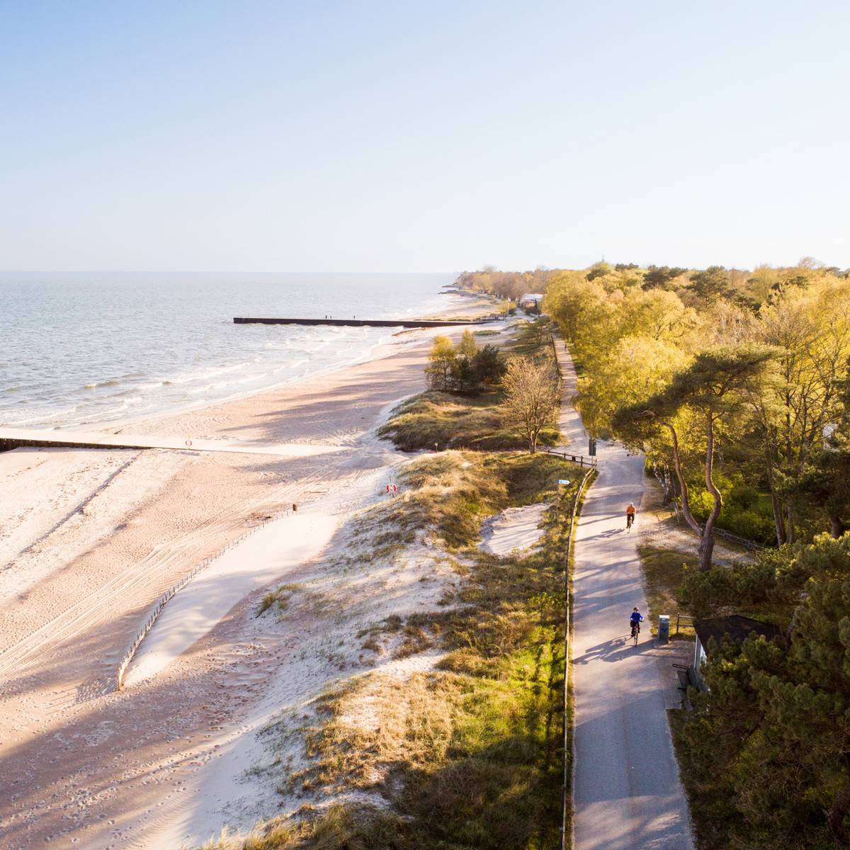
Stretching across Sweden’s southernmost region, the Skåneleden Trail offers a varied landscape that combines nature with culture. Divided into seven sub-trails, it passes through forests, open farmland, coastal scenery and picturesque villages, making it suitable for both shorter walks and longer hikes.

This is a trail where hiking is easily combined with local experiences. Expect everything from quiet lakes and deep gorges to sandy beaches and dramatic coastal cliffs. The Kullaleden section, running through Kullaberg Nature Reserve, is one of the most popular, known for its rugged scenery and outdoor activities. Along the way, you’ll also find two national parks – Stenshuvud and Söderåsen – as well as plenty of places to swim, eat well and explore local culture.

3 highlights along the Skåneleden Trail:

  • Ale’s Stones, often referred to as Sweden’s Stonehenge, a striking ship-shaped stone setting overlooking the sea near Kåseberga.
  • Ven, an island with its own section of the trail, perfect for a day trip by bike, with beaches, viewpoints and the Tycho Brahe Museum.
  • Sofiero Palace, a former royal summer residence known for its gardens, exhibitions and seasonal events.
Download the route map